Insider Brief
- Google and EDF partner to monitor global methane emissions and map oil and gas infrastructure using MethaneSAT satellite and AI, aiming to identify and mitigate methane leaks.
- Supported by a $100 million grant from the Bezos Earth Fund, MethaneSAT will provide comprehensive data on methane emissions to help transition to clean energy.
- MethaneSAT’s emissions data will be publicly accessible by end of 2025, facilitating climate change combat efforts through technology and collaboration.
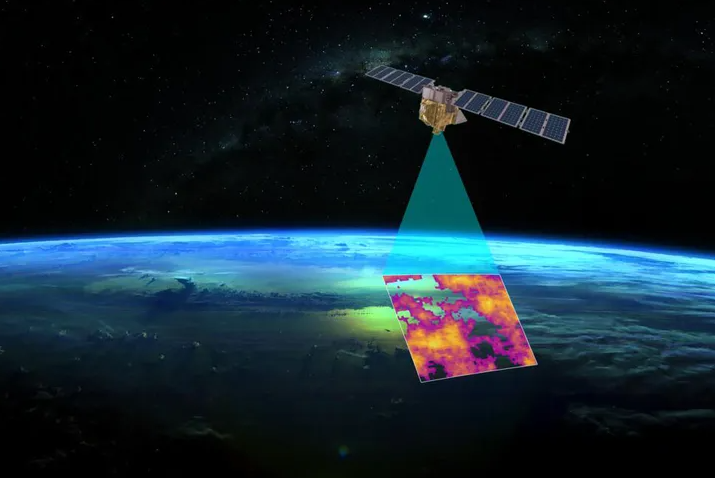
Google has teamed up with the Environmental Defense Fund (EDF) to embark on an exciting initiative aimed at tracking methane emissions and mapping oil and gas infrastructure globally from space. This collaboration seeks to identify and address the sources of methane leaks, a potent greenhouse gas significantly contributing to global warming. EDF is preparing to launch MethaneSAT, a satellite dedicated to monitoring methane emissions, complemented by Google’s AI technology to map pollution sources accurately. Methane, being 80 times more effective than CO2 at trapping heat in the atmosphere over 20 years, poses a significant challenge to climate change mitigation efforts. However, its shorter atmospheric lifespan offers a unique opportunity for rapid impact through pollution prevention.
EDF’s MethaneSAT mission, supported by notable entities including the New Zealand Space Agency and a $100 million grant from the Bezos Earth Fund, is set to provide comprehensive data on methane emissions worldwide. Google’s involvement will enhance the project by utilizing AI to identify fossil fuel infrastructure, facilitating a better understanding of pollution sources. This partnership not only aims to mitigate methane leaks, which cost the U.S. around 6.5 million metric tons of gas annually, but also emphasizes the necessity of transitioning to clean energy to achieve global climate goals.
The forthcoming MethaneSAT data, expected to offer a detailed global emissions overview by the end of 2025, will be publicly accessible through MethaneSAT’s website and Google Earth Engine. This initiative represents a critical step forward in leveraging technology and collaboration to combat climate change.
“Infrastructure changes rapidly, and keeping a map like this up to date requires constant input. But this is something that we in our maps and geo organization, we’ve built up a lot of expertise. We think this information is incredibly valuable for energy companies, researchers, and the public sector to anticipate and mitigate methane emissions.”
— Yael Maguire, vice president and general manager of Google’s Geo Sustainability team
“Methane dominates what’s happening in the near term. The timing really matters. Because if we do it really quickly and dramatically reduce those methane emissions, we can significantly reduce that rate of warming over the coming decades.
By the end of 2025, we should have a very clear picture on a global scale from all major oil and gas basins around the world.”
— Steven Hamburg, chief scientist at EDF
Featured image: A rendering of MethaneSat. Credit: Google
If you found this article to be informative, you can explore more current space industry news, exclusives, interviews, and podcasts.
Share this article:

